


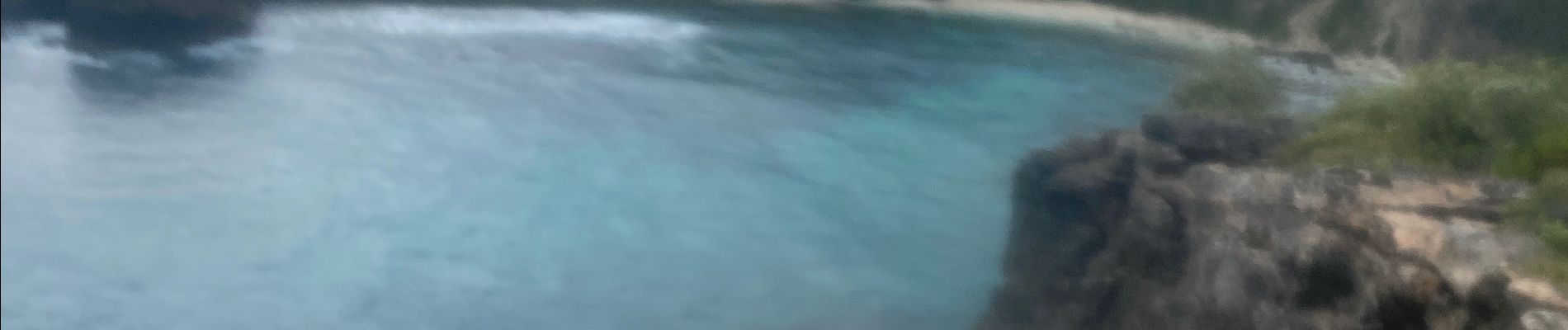
Moule le Litoral

sameja
User
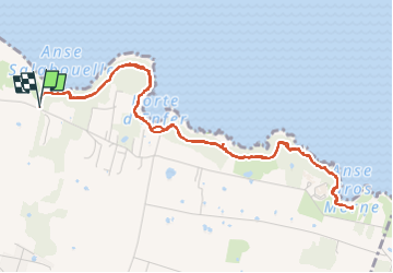

Length
8.5 km

Max alt
46 m

Uphill gradient
229 m
Km-Effort
11.5 km

Min alt
1 m

Downhill gradient
226 m
Boucle
Yes
Creation date :
2024-03-24 10:55:21.0
Updated on :
2024-03-24 12:45:16.907
1h33
Difficulty : Medium

FREE GPS app for hiking
 SityTrail
IGN / Geographical institutes
SityTrail Plus
The world is yours!
About
Trail Trail of 8.5 km to be discovered at Guadeloupe, Unknown, Le Moule. This trail is proposed by sameja.
Description
Là boucle
Photos


Positioning
Country:
France
Region :
Guadeloupe
Department/Province :
Unknown
Municipality :
Le Moule
Location:
Unknown
Start:(Dec)
Start:(UTM)
680967 ; 1805517 (20Q) N.
Comments